


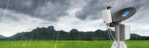


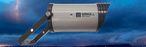


RADAR INTRUSION DETECTOR
High Value Area Protection
I-RADAR Intrusion Detection and Surveillance System using RADAR technology for strategic, critical and high-value facilities, both on the surface and at mid-height, with 3D information on the position of the intruder, for example a drone.
- Home / Solutions / RADAR Intrusion Detectors
RADAR Intrusion Detectors
I-RADAR Intrusion Detection System using RADAR technology
I-RADAR (Intrusion RADAR) is a compact, lightweight and easily deployable integrated advanced solution, specifically designed for critical infrastructure protection against LAND (pedestrians and vehicles), SEA (vessels) and AIR (drones).
Designed for both military and civil applications I-RADAR exploits X-band radar technology for an early warning in the event of an intrusion, and threat identification and classification, through the electro-optical sensors. With its low ownership cost and its ease of use, I-RADAR allows customers to secure their infrastructures from any type of incursions and in any conditions.
If you are concerned about SAFETY, surveillance must be constant, as you will prefer to be aware of any intrusion promptly in order to react in the shortest possible time. For that reason, I-RADAR is the essential solution.
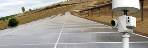
TYPICAL APPLICATIONS
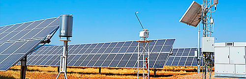
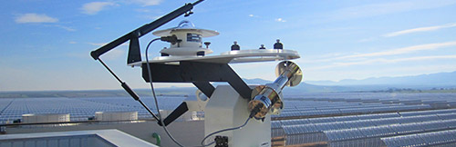
- Solar Power Plants
- Wind farms
- Seaports
- Airports
- Nuclear Power Plants
- Electrical substations
- Military Installations
| DETECTION PERFORMANCE | |
| Drones | Up to 2 Km |
| Walking man | Up to 5 Km |
| Vehicle | Up to 10 Km |
| Truck | Up to 13 Km |
| Small boat | Up to 8 Km |
ADDED VALUE
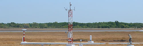
- Easy deployable on both fixed and vehicular applications
- Multi-sensor 360° protection
- Effectiveness in all scenarios and conditions
- Zero minimum detection range
- Zero minimum speed detection (drone hovering)
- Best-in-class sensors at an affordable price
- Rapid deployment and gracefull degradation
MAIN FEATURES
- Enhanced doppler processing
- Small target detection
- X-Band solid state technology
- Comprehensive, Intuitive and Ergonomic C2 software suite
- Low power consumption
- Integrated GPS
MAIN FUNCTIONALITIES
- Altitude data for flying objects
- Target identification & classification
- Layered structure
- Raw or doppler radar overlay visualization
- Automatic radar tracking
- Advanced video-tracking
- Optical sensors coverage visualization
- Track trails
- User definable alarm/allowed zones
- Visual and audible intrusion alarm
- Different map styles
- Automatic slew-to-cue over intrusion
- EOD manual control
- PiP and swap picture ( TV / IR )
- EOD recording
- Track data output to stakeholders
EOD : End of Data
PIP (Picture in picture)
DOCUMENTATION
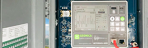
Dataloggers Serie 4000
Dataloggers Serie 4000
Dataloggers Serie 4000