


- Home / Products / Geophysical Instruments / Well logging
Well logging
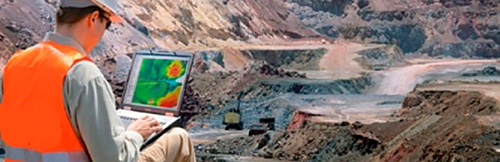
Well logging unit for subsoil surveys
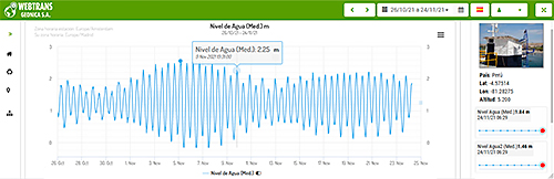
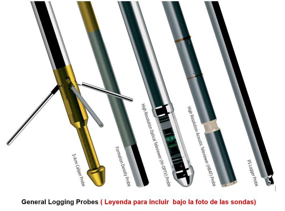
Geophysical well logging is a technique used in subsoil analysis that consists of continuous and simultaneous measuring and logging of different physical parameters along the entire depth of a borehole or well (Resistivity, Spontaneous Potential, Induced Polarization, Magnetic Susceptibility, Natural Gamma Radiation, Borehole Caliper, Verticality, etc.), using different interchangeable multiparameter probes that move inside the borehole, supported by an automated connection cable coiled on a winch located on the surface.
The electrical signals generated by the measurement probe are transmitted through the cable to an Electronic Control Unit also located on the surface, which processes and records the data so that it can be interpreted later to deduce the different characteristics and properties, or in other words, the lithology of the successive layers and materials through which the probe passed as it ascended along the borehole.
For the Visual Inspection of the boreholes, GEONICA also offers the same logging equipment, which can be fitted with a submersible probe with a color TV camera with lateral and frontal vision (axial), to make it possible to inspect the borehole in all directions and along its entire depth, withstanding immersions up to more than 1000 meters of water column.
The images captured by the camera are also transmitted by the connection cable to the surface electronics and recorded on disk to generate reports and analyses.
Main applications
- Mining research.
- Hydrogeological studies.
- Geotechnical studies.
- Testing for soil contamination.
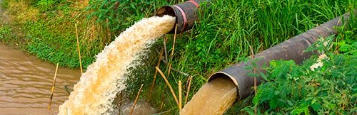
- Water quality.
- Saline intrusion.
- Visual inspection of the interior of wells and boreholes.
Well Logging
Related Products
Dataloggers Serie 4000
Dataloggers Serie 4000
Dataloggers Serie 4000