


- Home / About us / Key Projects & Success Stories
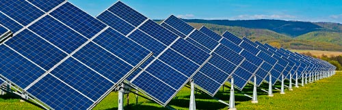
Solar spectral network (SSN) in Armenia and Canada based on SEMS-2000/3000.
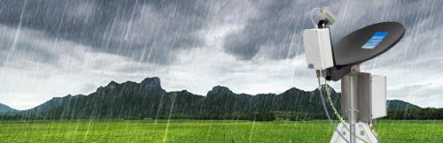
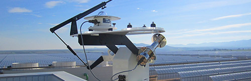
In recent years GEONICA has supplied measurement stations for the National Networks for the Evaluation of the Solar Energy Resource of Armenia and Canada, with the particularity that includes measurement of solar radiation resolved spectrally. These networks are based on our SEMS-2000/3000 system, which together with the measurement of global solar radiation incorporates its own solar tracker design, the SUN TRACKER-2000/3000 that enables the measurement of both diffuse and direct solar radiation.
The spectral measurement is based on the integration into the SEMS-2000/3000 system of the GEO-SolarSIM-D2, a spectrally-solved solar radiation measurement sensor. The GEO-SolarSIM-D2 is a revolutionary new approach to solar and atmospheric measurement, using simple rugged hardware and innovative software to drastically reduce the cost of direct solar spectrum measurement, aerosol optical depth, water vapor content and ozone level in a compact, energy-saving device.
In this way, the SEMS-2000/3000 System has been designed by GEONICA for the measurement and transmission of real-time data on all components of solar irradiance, as well as all the necessary meteorological parameters, making it even more interesting for the creation of National Networks for the Evaluation of Solar Energy Resources.
ARMENIA
The project was developed by a consortium of companies promoted by the Armenia Renewable Resources and Energy Efficiency Fund and funded by the World Bank Group with the intention of improving knowledge of the national solar resource in 2016. This network is initially composed of four stations located in Hrazdan, Masrik, Yerevan and Talin, with the intention of expanding it in the future. It is especially relevant that all the stations are located at a latitude between almost 1000 m and 2000 m since Armenia is a very mountainous country.
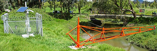
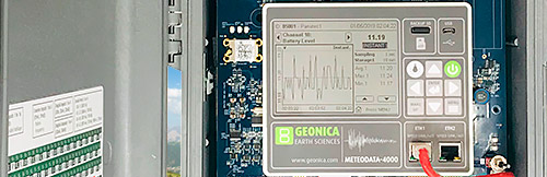
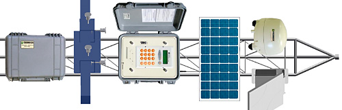
The four stations are based on a SEMS-3000 which, in addition to a complete set of meteorological and solar sensors, includes the GEO-SolarSIM-D2. In addition to Ethernet communications, the station includes a 3G/GPRS modem that allows monitoring and downloading of data over the local mobile network.
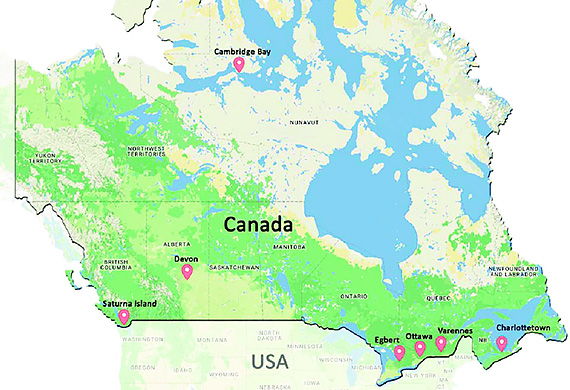
CANADÁ
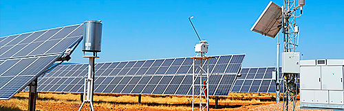
The Canadian Solar Spectral Irradiance Meter (CanSIM) network promoted by the Natural Resources Canada (NRC, Government of Canada), consists of seven stations in six provinces located in Ottawa and Egbert in Ontario (ON), Varennes in Quebec (QC), Charlottetown in Prince Edward Island (PE), Devon in Alberta (AB), Saturn Island in British Columbia (BC) and Cambridge Bay in Nunavut (UN). The last unit was commissioned in summer of 2017.
The typical CanSIM station consists of a SEMS-2000 system with a SUN SENSOR 2000 (for closed loop tracking) containing a GEO-SolarSIM-D2 and a GEO-SolarSIM-G for the measurement of direct and global solar irradiance respectively resolved spectrally, together with a GEO-SR20 pyranometer. Data is recorded at one-minute intervals. Data from each instrument is collected by the METEODATA 3000C datalogger/controller every minute and transmitted remotely to a central server for storage and analysis. The CanSIM station provides a wealth of atmospheric and solar data, including ambient temperature, pressure and humidity, DNI and GHI, spectral DNI, GHI and AOD in the range 280-4000 nm, total atmospheric column ozone and precipitable water vapor content. In addition, the total horizontal diffuse spectral irradiance (DHI) and total DHI can be easily calculated from spectral DNI and GHI, as derived from GEO-SolarSIM-D2 and GEO-SolarSIM-G respectively.
- 08/07/2016
- PDF Document